![]()
HOME
Article
GPS Track & Elevation Profile
Google Earth file (kmz)
Photo Gallery
Video
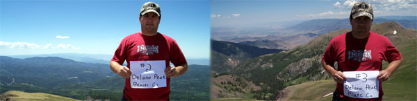
Delano Peak - Beaver & Piute Counties- 12,169 ft. - High-Point Rank: 7th
Right in the middle of a 3-day camping trip with the family, we decided to conquer another highpoint known as Delano Peak. The Beaver and Piute county line runs right down the summit allowing us to get 2 peaks for 1 hike – sounded like a bargain at the time. We had no idea what to expect. From the research done before the trip, we gathered it as pretty much of a “no specific trail, just hike upwards” kind of a scramble. So after studying topo maps and guessing which would be a trouble-free route, we took off from Griffith Creek near Big John Flat and started hiking up…..and up….and up some more.
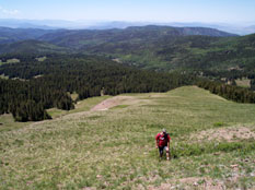
We started at about 11:30 am and the temperature was a beautiful 63 deg. For 2 hours we crossed 1.5 miles and gained about 1,700 feet in elevation.
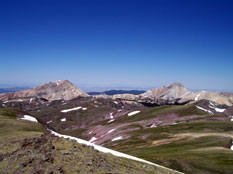
Every 50 feet or so, we’d have to pause to catch our breath and look back as not to miss the view that got bigger and better each time. Everyone was right. There were no trails up the peak, but as long as you were still climbing, you’d get there.This is the first time I can remember hiking above timberline and the views were magnificent. The hillside is covered in replicating patterns of short green grasses and wildflowers, with a few distinct snow patches and jagged ridges of rock. Across the valley to the Northwest we could make out dozens of white spots trekking their way across the flourishing hillside. As we got closer we identified them as mountain goats.
We kept our eyes on the summit and as we inched closer and thought we were close - only to look a little to the right at a higher summit with a mailbox set distinctly against the blue sky. We knew that was our ultimate goal and pushed on. (Kudos to whoever hiked this peak with a mailbox and a 4x4 piece of lumber.) Finally, we reached the peak and took in the 360 degree view. We could see from Pine Valley in the South to Mt Nebo in the North…and everywhere in between.
The wind picked up and started to get quite cool – enough to make our noses run, but not enough to dig out our sweatshirts from the bottom of our packs. After a good 20 mins or more at the top, we started down a different way than we had come up – of course. We wanted to get to the bottom and follow the snow runoff down its meandering course. We were moving 4 times faster than we had coming up and were having no difficulty breathing. It didn’t take long at all to get down and surprisingly, our knees did much better than the previous weekend on Pine Valley.
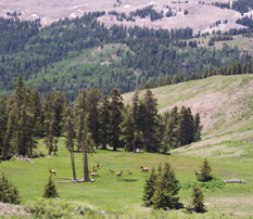
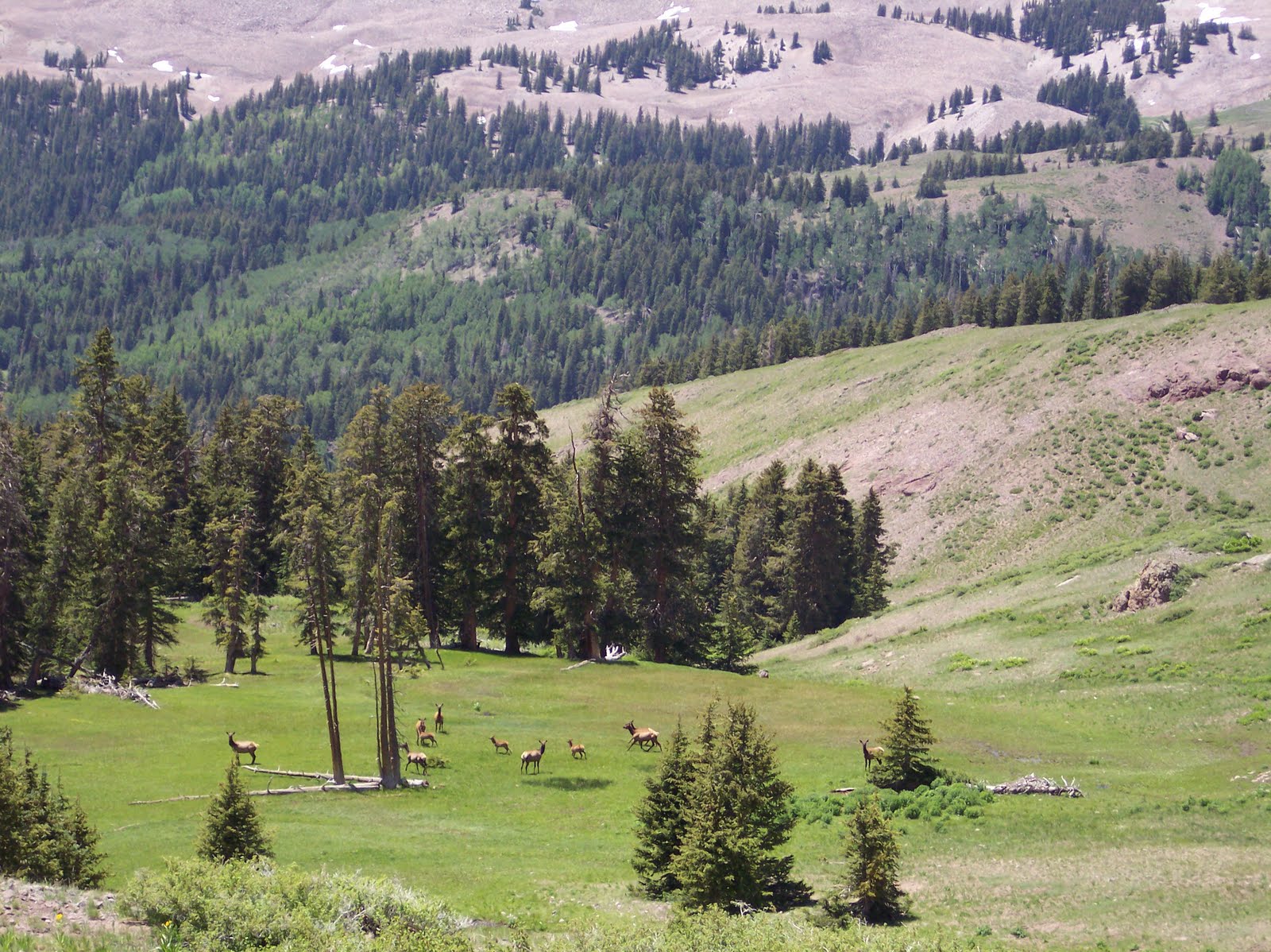
We witnessed a herd of Elk in a small swampy meadow and also saw some deer grazing on the hillside. After getting back to the truck, we settled in for the dusty ride back to camp surprised at how much easier it had been in relation to Signal Peak a few days earlier. This turned out to be about a 3 mile round trip. It was something I never would have done for fun….but because it’s a step closer to my goal, I was able to witness some remarkable views and stand somewhere I never dreamed that I would. Stand somewhere I will never forget. 3 counties down, 26 more to go.
We started at about 11:30 am and the temperature was a beautiful 63 deg. For 2 hours we crossed 1.5 miles and gained about 1,700 feet in elevation.
Every 50 feet or so, we’d have to pause to catch our breath and look back as not to miss the view that got bigger and better each time. Everyone was right. There were no trails up the peak, but as long as you were still climbing, you’d get there.This is the first time I can remember hiking above timberline and the views were magnificent. The hillside is covered in replicating patterns of short green grasses and wildflowers, with a few distinct snow patches and jagged ridges of rock. Across the valley to the Northwest we could make out dozens of white spots trekking their way across the flourishing hillside. As we got closer we identified them as mountain goats.
We kept our eyes on the summit and as we inched closer and thought we were close - only to look a little to the right at a higher summit with a mailbox set distinctly against the blue sky. We knew that was our ultimate goal and pushed on. (Kudos to whoever hiked this peak with a mailbox and a 4x4 piece of lumber.) Finally, we reached the peak and took in the 360 degree view. We could see from Pine Valley in the South to Mt Nebo in the North…and everywhere in between.
The wind picked up and started to get quite cool – enough to make our noses run, but not enough to dig out our sweatshirts from the bottom of our packs. After a good 20 mins or more at the top, we started down a different way than we had come up – of course. We wanted to get to the bottom and follow the snow runoff down its meandering course. We were moving 4 times faster than we had coming up and were having no difficulty breathing. It didn’t take long at all to get down and surprisingly, our knees did much better than the previous weekend on Pine Valley.
We witnessed a herd of Elk in a small swampy meadow and also saw some deer grazing on the hillside. After getting back to the truck, we settled in for the dusty ride back to camp surprised at how much easier it had been in relation to Signal Peak a few days earlier. This turned out to be about a 3 mile round trip. It was something I never would have done for fun….but because it’s a step closer to my goal, I was able to witness some remarkable views and stand somewhere I never dreamed that I would. Stand somewhere I will never forget. 3 counties down, 26 more to go.