![]()
HOME
Article
GPS Track & Elevation Profile
Google Earth file (kmz)
Photo Gallery
![]()
Video
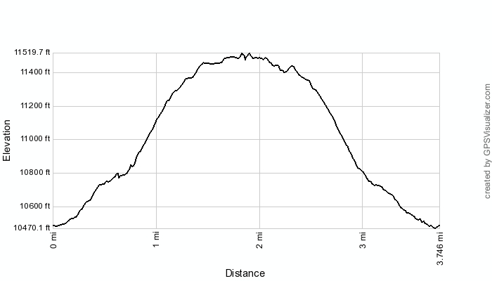
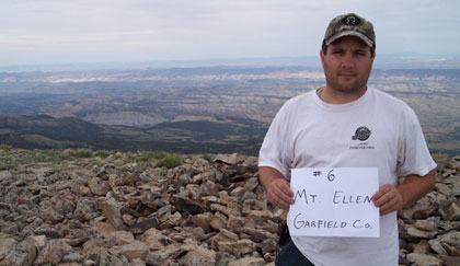
Mt. Ellen - Garfield County - 11,522 ft. - High-Point Rank: 12th
Time: 3:06:27
Elev Gain:: 1,225 feet
|
|
HOME |
Article |
||
GPS Track & Elevation Profile |
||
Google Earth file (kmz) |
||
Photo Gallery |
||
|
Video |
|
Mt. Ellen - Garfield County - 11,522 ft. - High-Point Rank: 12th |
Distance: 3.75 miles Time: 3:06:27 Elev Gain:: 1,225 feet |
|