![]()
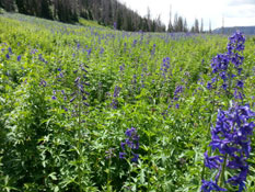
As we headed to South Tent Mountain, the road would have been good and fast-going but someone had driven on it when it was very muddy and left huge ruts in it that really slowed us down. There are a lot of beetle infested trees in this area which is sad to see. It really makes the forrests look dead. However, the fields made up for it as they were just covered in gorgeous wildflowers.
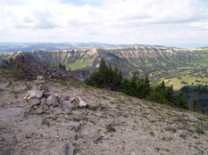
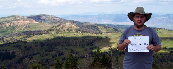
We parked in a meadow and started walking toward a lower saddle so we could hit the ridge and work the rest of the way up. The storm clouds looked like they could hit any minute so we had to hurry. There were tons of flowers of all kinds all the way to the top where the view was great with the low, dark clouds and 360 degrees of mountain ranges. The wind started to pick up on the way down and as we drove away, it started to sprinkle. Rain in the mountains is always awesome. The clouds are so much closer and compliment the scenery in such a way that makes you silently watch as two massive objects, both mountains and clouds, collide. We headed out on Skyline drive which is the highest road in the US for as long as it is. It goes for quite a ways at a very high altitude. We were done for this year and we headed home, ending at 1,063 miles and anxious to see where next year would take us.