![]()
HOME
Article
GPS Track & Elevation Profile
Google Earth file (kmz)
Photo Gallery
![]()
Video
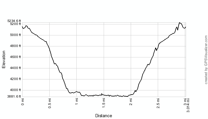
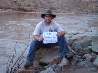
Colorado River - Wayne County - 3,865 ft. - Low-Point Rank: 5th
Time: 3:26:45
Elev Loss: 1,855 feet
|
|
HOME |
Article |
||
GPS Track & Elevation Profile |
||
Google Earth file (kmz) |
||
Photo Gallery |
||
|
Video |
|
Colorado River - Wayne County - 3,865 ft. - Low-Point Rank: 5th |
Distance: 3.01 miles Time: 3:26:45 Elev Loss: 1,855 feet |
|
This map was created using GPS Visualizer's do-it-yourself geographic utilities.
Please wait while the map data loads...