![]()
HOME
Article
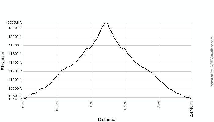
GPS Track & Elevation Profile
Google Earth file (kmz)
Photo Gallery
![]()
Video
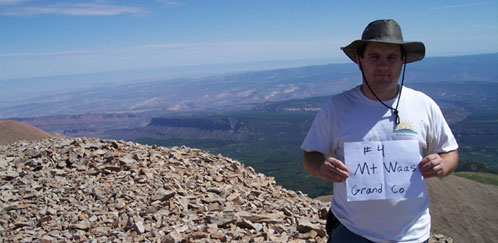
Mt. Waas - Grand County- 12,331 ft. - High-Point Rank: 4th
Time: 4:09:32
Elev Gain:: 1814 feet
|
|
HOME |
Article |
||
GPS Track & Elevation Profile |
||
Google Earth file (kmz) |
||
Photo Gallery |
||
|
Video |
|
Mt. Waas - Grand County- 12,331 ft. - High-Point Rank: 4th |
Distance: 2.48 miles Time: 4:09:32 Elev Gain:: 1814 feet |
|
© 2010-2014 www.skyhighutah.com - all rights reserved | Contact Webmaster |