![]()
Saturday I had the opportunity to help out family who live in Fillmore. I decided to pack up and leave 2 days early and take the long scenic route, visiting 3 low points on the way.
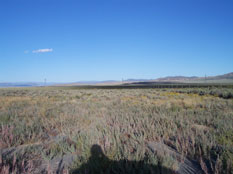
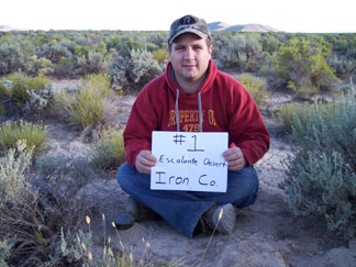
Our first stop was the low point for Iron County in the Escalante Desert. After Korbin got out of school we left town, determined to get there before dark and find a place to camp somewhere nearby. The weather said it could get down to 33 degrees and we weren’t sure how our night was going to turn out.
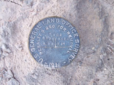
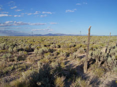
We left Cedar City heading West on Lund Highway and then followed the railroad tracks Northeast from Lund. We came across 8-10 antelope on the way that didn't seem to care about the dust we were kicking up. After arriving, I wasted a lot of time trying to figure out how to put coordinates into my gps so I would be sure to find the low spot. I had done it years before so I knew it was possible but my mind wasn’t remembering. All it could concentrate on was the sun getting lower and lower. I knew it was about ¼ mile along a fence line and that there was a marker there so instead of wasting more time, we took off walking the fence, looking for that marker. Luckily we had no problem finding it and I completed my first low point. It only took me 20 minutes and ½ mile of walking round trip….nothing compared to Delano or Signal Peak……it was actually quite pleasant.
The wind was blowing, the air was cooling off and the sun was getting low so we snapped some pictures and booked it back to the truck. Then we started driving north looking for any kind of a side-road or somewhere to camp for the night. We finally took a road to the west and after a few hills, we found a nice clear spot near a wash in the Juniper trees. Set up camp in 30 mins and we were ready for the cold night….which didn’t turn out to be bad at all. However, we didn’t sleep too well with the wind blowing the tent and the thought of cows stampeding camp. Friday morning we woke up at daylight, packed up and headed to Beaver County.
See article for Beaver county.