![]()
See Iron County for previous day on this trip.
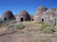
Well, no cows came into camp that night and we were on the road by 9am. Made a detour to Milford to make sure our gas tank was full before heading into the vast nothingness of Western Utah. Headed West out of Milford and made a stop in the ghost town of Frisco. It was neat to explore the old crumbling houses, the kilns, and imagine the lawless life here 100 years ago among thousands of its inhabitants. The graveyard was the most intriguing. There were some old headstones from 1880’s as well as some unmarked graves. Most graves seemed to be of infants - at least those whose headstones were still readable.
After some time there, we moved on and took a dirt road to the north a little further west. This road passed through the ghost town of Newhouse that seemed to have more ruins than Frisco did but constructed of newer material.
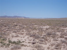
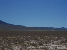
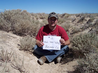
We were expecting a 1 mile hike one way to get to the low point of Beaver County which was along an old ditch in the Wah Wah Valley – Native American for "middle of nowhere" I'm sure. However, we found an old 2-track road that got us pretty close and there was basically no vegetation over 6 inches tall and the side of the ditch was mostly clear so instead of walking 2 miles, we drove to within 200 feet. We could have gotten even closer but needed to stretch our legs a little bit. The low point was in the bottom of the ditch in the middle of a very wide and flat valley. The dust was similar to talcum powder, very fine and gets everywhere. The valley was filled with dust devils as the air heated up and there was a huge mirage in the distance to the north. Korbin was fascinated by this and tried his best to understand my explanation even though he was positive there was a lake out there.
After a quick stop there in the low 80 degree air, we loaded back up and headed toward Millard County. According to google maps, there was a shortcut that would lead us to a faster road. We could barely make out the road, just a faint hint of tracks among the low brush. Probably hadn’t been driven on in years but it worked out great – no dead ends.
See Millard county for the rest of this trip.