![]()
See Iron and Beaver county for previous articles on this trip:
Millard County low point is 55 miles from the Beaver County low point as the crow flies. My previous planning with google had me mapping out the most direct route there since there are roads everywhere. However, because of our experience with google in Beaver County and the fact they don’t differentiate between a good gravel road and a 2-track that hasn’t been used for half a decade, we decided to stick to the roads that were named. It was the right decision as most of the way there we could clip along at 55-60 mph on very smooth gravel roads.
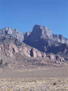
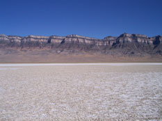
There were 2 roads that would get us close to the low point and according to the map, they were nearly the same distance of hiking. I had read about one option that had mentioned a lot of mud….se we took the other option. We passed near Notch Peak in the Sawtooth Mountains. It is the tallest vertical slab of limestone in North America and at 2200 feet of vertical drop, it is the second highest in the United states only to Yosemite's El Capitan . And in the afternoon sun, it was magnificent.
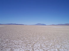
It was a 3.2 mile roundtrip hike across an old lake bed and it was 2:30 in the afternoon sun. Luckily it was probably only 80 degrees outside. I tried out my new trekking poles I had bought to help with my ailing knee. Of course they weren’t really needed on this flat ground but gave me a good feel for them and convinced me that they would be very beneficial on hikes with a lot of ups and downs. Supposedly they take about 30% of the stress off your knees and legs and allow you to walk further since you are spreading out the work across your whole body. I’ll have to try them on a high point hike to be absolutely convinced.
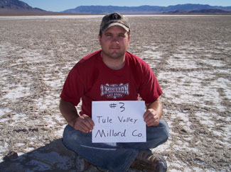
The hike was pretty much a straight line and with gps in hand we made our way across the lake bed. The surface under our feet was entertaining as we walked. In some parts it was like walking on a wafer as it crunched underfoot and in other places it was almost like memory foam as it gave way but was completely dry. After reaching what seemed to be the middle of the lake bed, we found 3 stones set up in a triangle. There were no other rocks nearby so we must have been in the right place. There were also plenty of tire tracks around where people must come out to see how fast they can get going.. It was a little funny to know that we probably could have found a way to drive right up to the spot instead of walking 3 miles but then again, we wouldn’t have slept as well that night.
I was surprised how well Korbin did. For 7 years old, he never complained and probably hiked twice as far as us with all his running around bushes and goofing off. Back in the truck, we headed over to what has been nicknamed “the loneliest highway in the US” and headed East toward Delta. We ended up in a Forest service campground East of Oak City. We arived right before dark again and raced to set up our tent. We were the only ones in the entire campground and with the nearby Oak Creek, we were soothed to sleep and slept so much better than the night before even though it was a little colder. 2 days and 3 low points, all of which were out in the middle of nowhere. The truck is completely covered in powder but it was a lot of fun driving on backroads, miles from anyone else and camping wherever we ended up at the end of the day. 26 more low points to go.