![]()
HOME
Article
GPS Track & Elevation Profile
Google Earth file (kmz)
Photo Gallery
![]()
Video
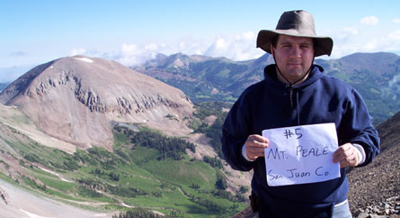
Mt. Peale - San Juan County- 12,721 ft. - High-Point Rank: 3rd
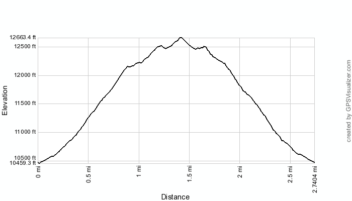
Time: 4:31:40
Elev Gain:: 2,349 feet
|
|
HOME |
Article |
||
GPS Track & Elevation Profile |
||
Google Earth file (kmz) |
||
Photo Gallery |
||
|
Video |
|
Mt. Peale - San Juan County- 12,721 ft. - High-Point Rank: 3rd |
Distance: 2.74 miles Time: 4:31:40 Elev Gain:: 2,349 feet |
|
© 2010-2014 www.skyhighutah.com - all rights reserved | Contact Webmaster |