![]()
HOME
Article
GPS Track & Elevation Profile
Google Earth file (kmz)
Photo Gallery
Video
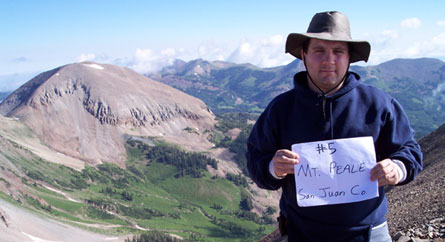
Mt. Peale - San Juan County- 12,721 ft. - High-Point Rank: 3rd
Well after visiting the Grand County Lowpoint the day before, we had an alarm set for 5am so we could get up and get going before the storms appeared. The alarm sounded, I took a look outside, could still see storm clouds and it had just been raining a short time earlier so we decided to await daylight before making a decision. I went back to sleep and awoke again at 6am. That hour was the best I had slept all night. We took another look out of the tent. The weather was clear so we decided to make a run for the summit.
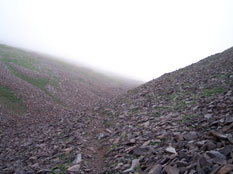
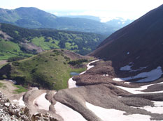
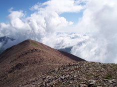
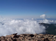
We jumped out of bed, stuffed bagels in our mouths, grabbed our day packs and took off up toward the towering peak. We didn’t even break down camp first. Within 100 feet, my shoes were soaked through, my pant legs were dripping and my wool socks could be felt sloshing with every step. We located the trail around an avalanche zone that had left a mess of twisted and fallen trees. We headed uphill through a freshly watered forest and soon hit the talus and followed a steep draw up. This draw soon filled with snow that was the perfect hardness and dirtyness that it made climbing a lot easier than scrambling over the scree. We left the colour after a while and followed a drainage ditch or trail up the ridgeline. It was awesome to stand on the ridgeline between two massive valleys and take in the view. The ridge was maybe only 3 feet wide in some places with steep dropoffs on either side. The wind picked up and turned cold and the wispy clouds started twirling around Mt. Peale and neighboring peaks. Worrying about being turned around by a quick gathering storm, we hurried on. We followed the ridgeline toward the peak, careful to stay on the east side which gave us better protection from the wind. Often while hiking to the peak, the fog would roll in and billow over the ridge above us, creating an awesome effect. We finally made it to the top where we made out Moab in the distance along with Canyonlands and Mt. Waas we had climbed 2 days ago. We were so high above the gathering clouds in distant valleys that it appeared as if we were flying in an airplane.
It took about 3 hours to climb and after 30 mins at the peak, we headed down. We successfully made it to the bottom, broke camp and were on the way before any storms hit. Actually....they never did hit the rest of the day.
Just as usual, we decided to return to Moab via a different route. We continued past the La Sal Pass and onto an ATV road that was very rocky, had many sharp turns, extremely steep and washed out sections. At one time, we were actually driving across a flattened, compact section of talus that had been part of a landslide at one time. This is why I love my Toyota. It is small, predictible and maneuverable. The road was only 10 miles long but with the weight in the back and the road conditions, it took us nearly 2 hours to travel it.
After making it back to Moab, we decided to head to the Old City Park to spread everything out to dry, eat lunch and reorganize the truck. After laying everything out on the grass, we realized that we had created our own little homeless camp. We layed on the grass, ate, relaxed and for a moment, felt partly clean.
This park had a pretty good sized pond that was fenced in and populated with many geese and ducks. Anytime anyone came close, they raised a racket, expecting to be fed. I removed my wet shoes and socks and let the grass clean between my toes. We then left my dad there as the vagrant to watch the stuff and headed into town to get ice, bread, gas and the desperately needed mosquito repellent.
We returned, packed up and headed back to Green River on our way to Han’s Flat Ranger Station and to our next Low Point at the Doll House in Canyonlands National Park.