![]()
HOME
Article
GPS Track & Elevation Profile
Google Earth file (kmz)
Photo Gallery
Video
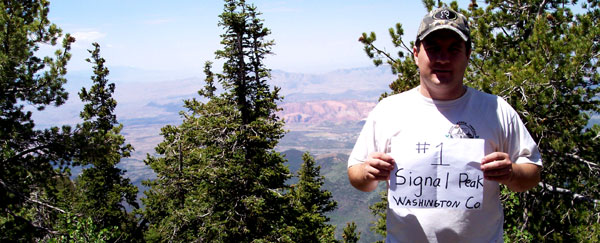
Signal Peak - Washington County - 10,365 ft. - High-Point Rank: 21st
Time: 10:06:22
Elev. gain: 5,591 ft.
|
|
HOME |
Article |
||
GPS Track & Elevation Profile |
||
Google Earth file (kmz) |
||
Photo Gallery |
||
Video |
||
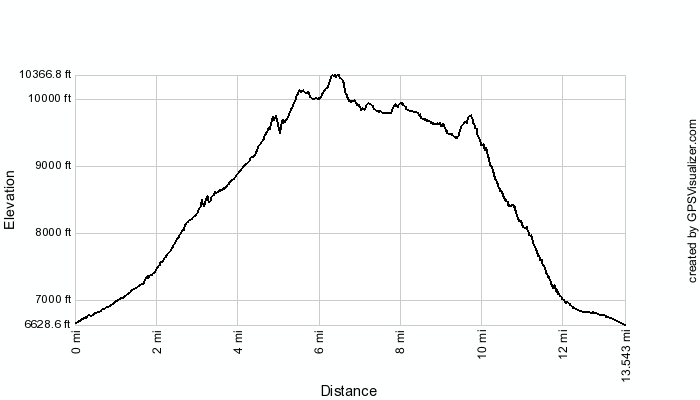
Signal Peak - Washington County - 10,365 ft. - High-Point Rank: 21st |
Distance: 13.54 miles Time: 10:06:22 Elev. gain: 5,591 ft. |
|
This map was created using GPS Visualizer's do-it-yourself geographic utilities.
Please wait while the map data loads...
© 2010-2014 www.skyhighutah.com - all rights reserved | Contact Webmaster |