![]()
HOME
Article
GPS Track & Elevation Profile
Google Earth file (kmz)
Photo Gallery
Video
Jordan River - Utah County - 4,475 ft. - Low-Point Rank: 18th
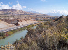
After visiting Summit, Morgan, Salt Lake and Tooele counties the day before, we decided to grab 2 more on our way home. We headed down Redwood Rd in Salt Lake until we were almost to Camp Williams. Near the Veteran’s Memorial Park there is a trailhead for the Jordan River Parkway. It was a 10 minute walk down the paved path to near a pump station at the Jordan River Narrows Diversion Dam. In the early days of Salt Lake, this dam provided irrigation water to the entire valley.
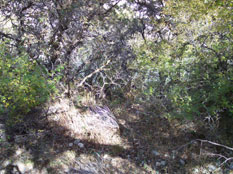
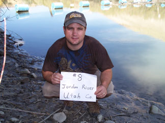
We had to bushwack down a very steep and overgrown slope down to the river but we made it with not much trouble. We came out just upstream from the pump station near some blue barrells that stretched across the river to keep boaters and others away from the pumps. The Jordan River is a very slow moving, green, murky river so I had no desire to get my feet wet here. Standing on the muddy bank was good enough.
We then took the short hike back up to the trail, noticing that the ground was littered with tons of snail shells that Korbin was fascinated with and had to stuff his pockets with as many as he could before we dragged him by the hand to the trail. Right above the trail are 2 large wind turbines. They weren’t moving when we got there but as we were leaving, there was a slight breeze and they were spinning pretty good. Now that Korbin was worn out, we headed up Provo Canyon to check off Wasatch County.